Up to now in my blog I have been trying to outline the uses of Photogrammetry in the two main areas of archaeology, recording and interpretation. Some things I have discussed were specific to preserving as much data as possible of an archaeological feature or object, by creating a virtual copy of it. Other posts were concerned with what can be done once that model has been made, to further our understanding.
This post is mostly about recording a specific type of feature, but it opens up some possibilities to help interpret them as well.
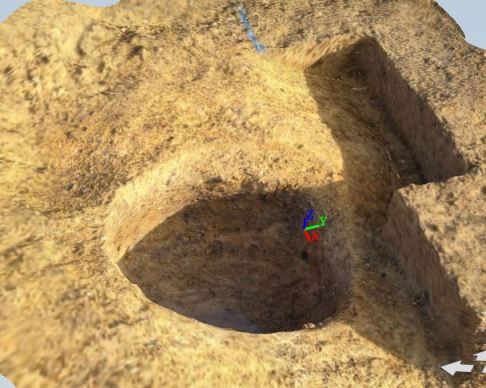
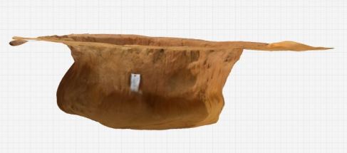
On some occasions during archaeological excavations we happen to stumble across some particular pits that present particular difficulty when planning. In these cases the issue is that the sides of the pit are not gradual or even vertical, but they actually overcut the side, giving it a bulging shape. During an excavation at Ham Hill, Somerset, one of the pits there had this particular shape due to it’s use. It was probably used to store grain, and the presence of a smaller hole at the top meant that the preservation would have been better.
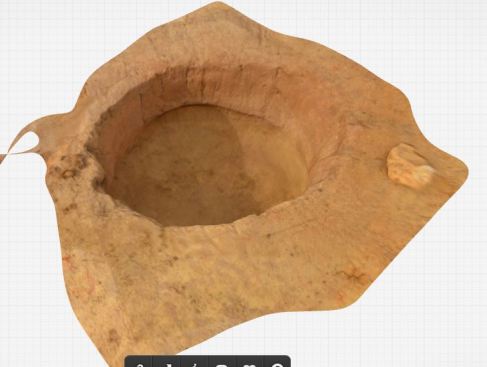
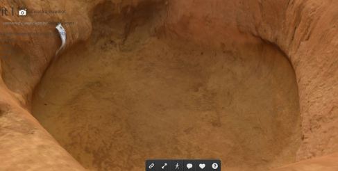
The plans draw of the pit were excellent, but even so it is difficult to convey the true shape of the feature using only 2D resources. I therefore created a model of it, by taking photographs like I normally would for a regular feature, with the addition of a few more from within the feature itself, by dropping the camera within it. The results are as follow:
Not only can you view the feature from the top, but it is even possible to see it from the sides, and rotate it that way, making it ever so clear how the feature was even now it is gone.
In addition to that, the bulge is much clearer, and it is easier to draw conclusions on its use. As a permanent record it is excellent, as not only do we not loose any information, but we can also gain more than what we could see being limited by the simple top view.
It also opens up new possibilities. As of yet I have not experimented much with Maya 3D, however I have had a brief overview of how the program works and what it is capable of. One of my colleagues once showed me how to reconstruct a pot from the profile, and then proceeded to calculate the capacity of the finished pot. Theoretically speaking it should be possible to import the finished model of the pit in Maya, and then use the same algorithm to calculate how much grain the pit could have had at a time, which could help understand the density of the population of the area, as well as a lot of other interesting questions.
And the technology doesn’t stop here. This may be a very specific example, but the same ideas can be applied to many different kinds of features. Those with particular bases can be easily recorded by making a model of them, or stone structures can be perfectly copied digitally rather than only drawn by hand. There is still a lot of applications to discover.


